
ANACOSTIA RIVER
A river older than the capital. A living archive of people, wildlife, work, damage, resistance, and renewal.
Long before Washington, D.C., this tidal river moved through broad marshes, forested banks, tributary streams, mudflats, coves, and productive shallows. Indigenous communities had lived within the greater Anacostia and Potomac region for thousands of years. The Nacotchtank were the principal Indigenous people associated with the lower river at European contact.
The river was never background scenery. It was food, travel, shelter, trade, knowledge, identity, and life. River History begins there.
THE NATION’S RIVER
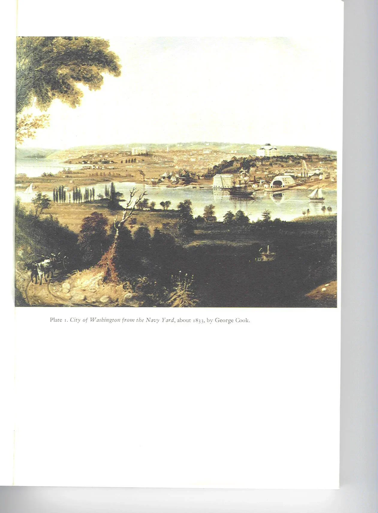
In 1790 and 1791, plans for a new federal capital were laid across an older river homeland. The L’Enfant plan organized avenues, squares, government buildings, and ceremonial space—but the Anacostia, then widely called the Eastern Branch, was already a working geographic force.
The capital did not create the river. It inherited it. The waterway shaped transportation, defense, settlement, commerce, and the growth of neighborhoods east and west of the channel. Each new map layered federal ambition over Indigenous history, tidal ecology, and an existing network of human movement.
To read Washington correctly, we must read the river beneath the city plan.
THE EASTERN BRANCH
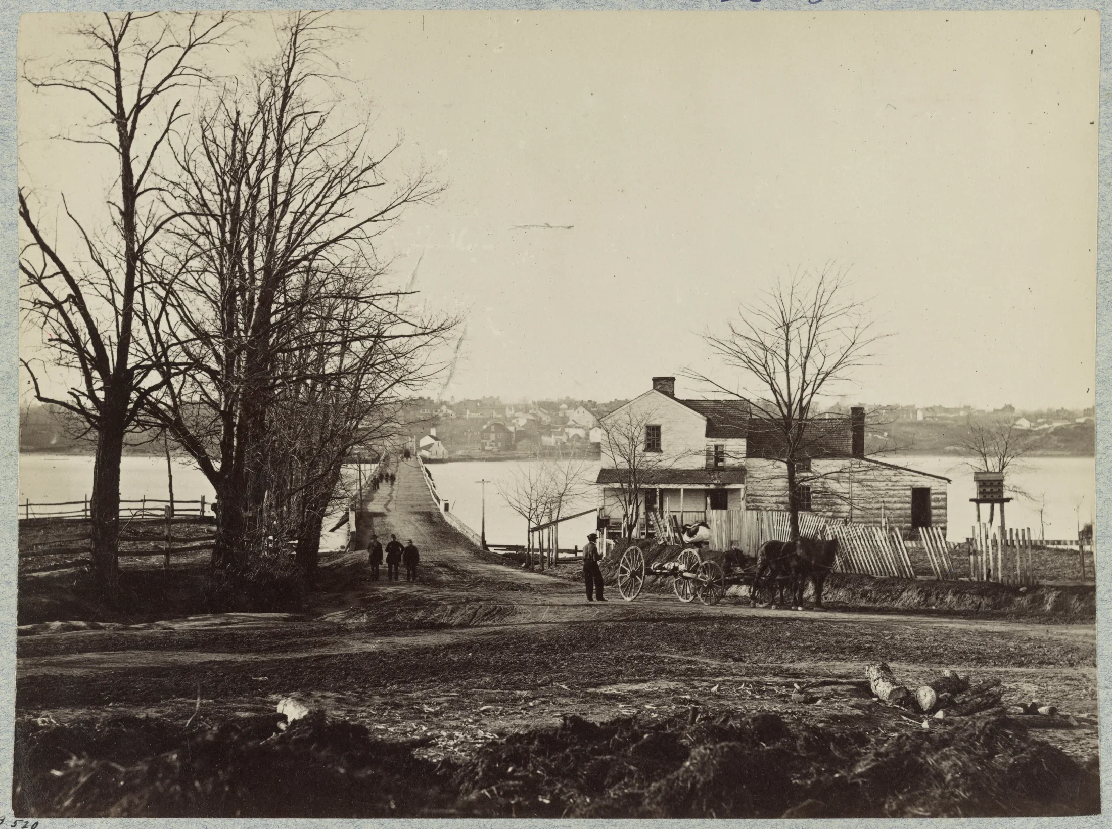
Nineteenth-century images show the Eastern Branch as a corridor of bridges, boats, wharves, timber, military movement, fishing, and commerce. The 1865 Navy Yard Bridge record captures a river crossing at the close of the Civil War—a structure joining communities while the water carried the work of the capital.
The Navy Yard and riverside industries made the Anacostia essential to Washington’s economy. Materials, labor, vessels, and people moved along and across it. But navigation projects, shoreline construction, and urban waste steadily changed how the river flowed and what could survive in it.
A working river can build a city while absorbing the city’s consequences.
WILD RICE, MARSHES, ABUNDANCE
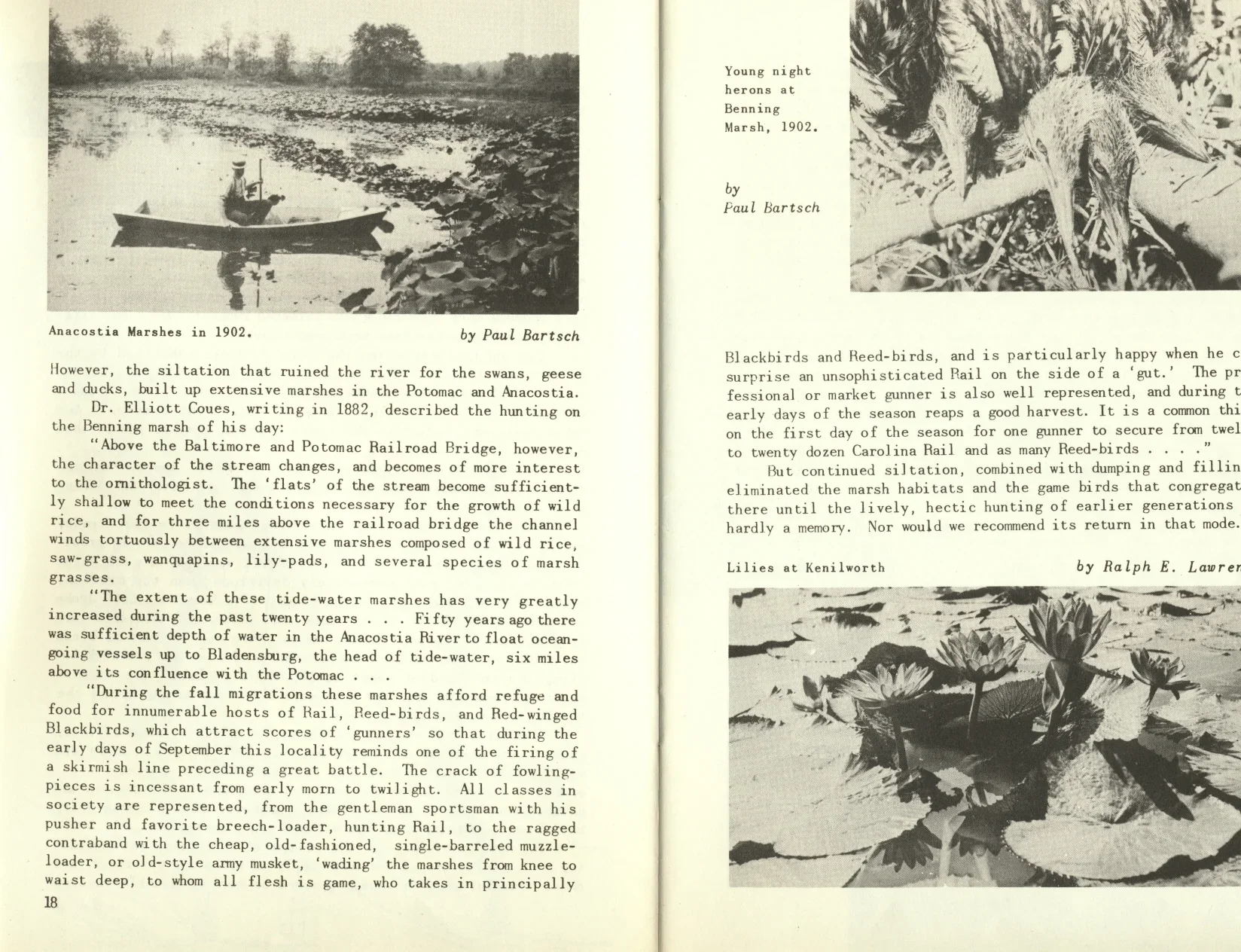
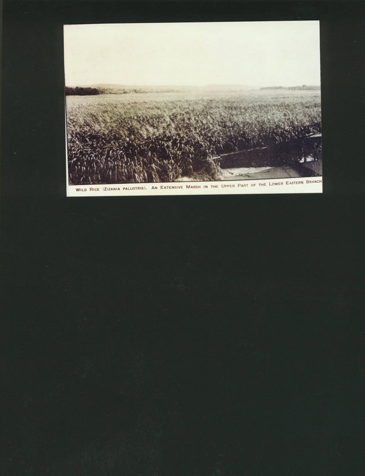
Early records and photographs reveal a river edged by extensive tidal marshes. Wild rice, aquatic plants, mudflats, islands, and shallow water supported fish, waterfowl, insects, turtles, and other wildlife. These wetlands slowed water, stored sediment, softened floods, and created nursery habitat.
People fished, hunted, gathered, traveled, and spent time along the shoreline. The river’s abundance was ecological and social: it fed families, created livelihoods, and gave nearby communities a place to gather.
The 1902 marsh documentation and 1919 wild-rice images are not empty landscapes. They are evidence of a functioning urban estuary before much of its shallow habitat was filled or re-engineered.
ENGINEERING THE RIVER
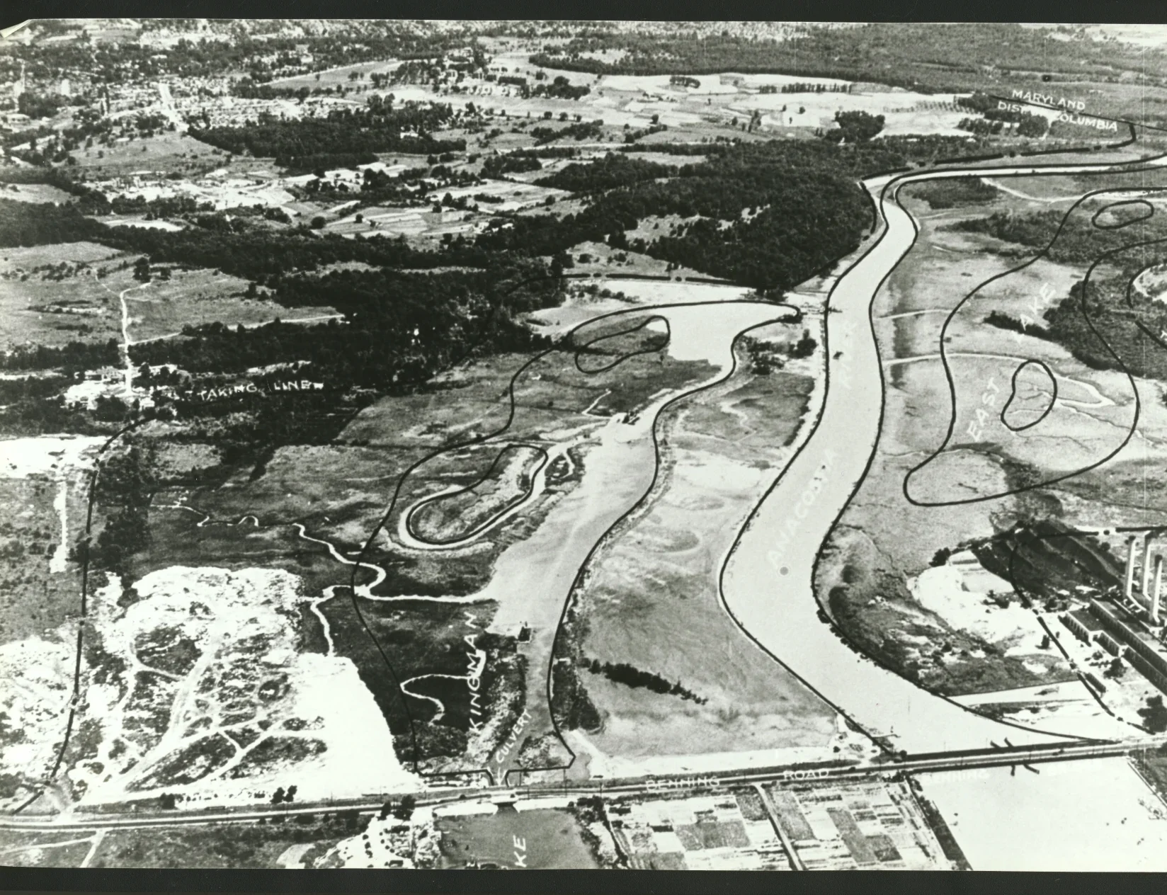
By the early twentieth century, public officials increasingly treated tidal marshes as problems to be controlled. Dredging deepened channels; excavated material filled wetlands and reshaped shorelines. Flats and marshes were converted into engineered land.
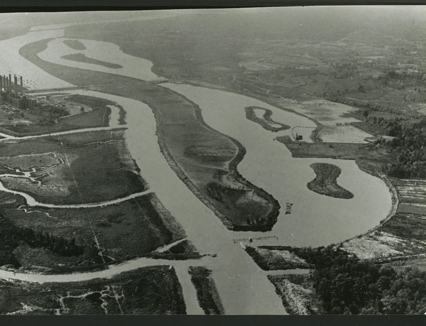
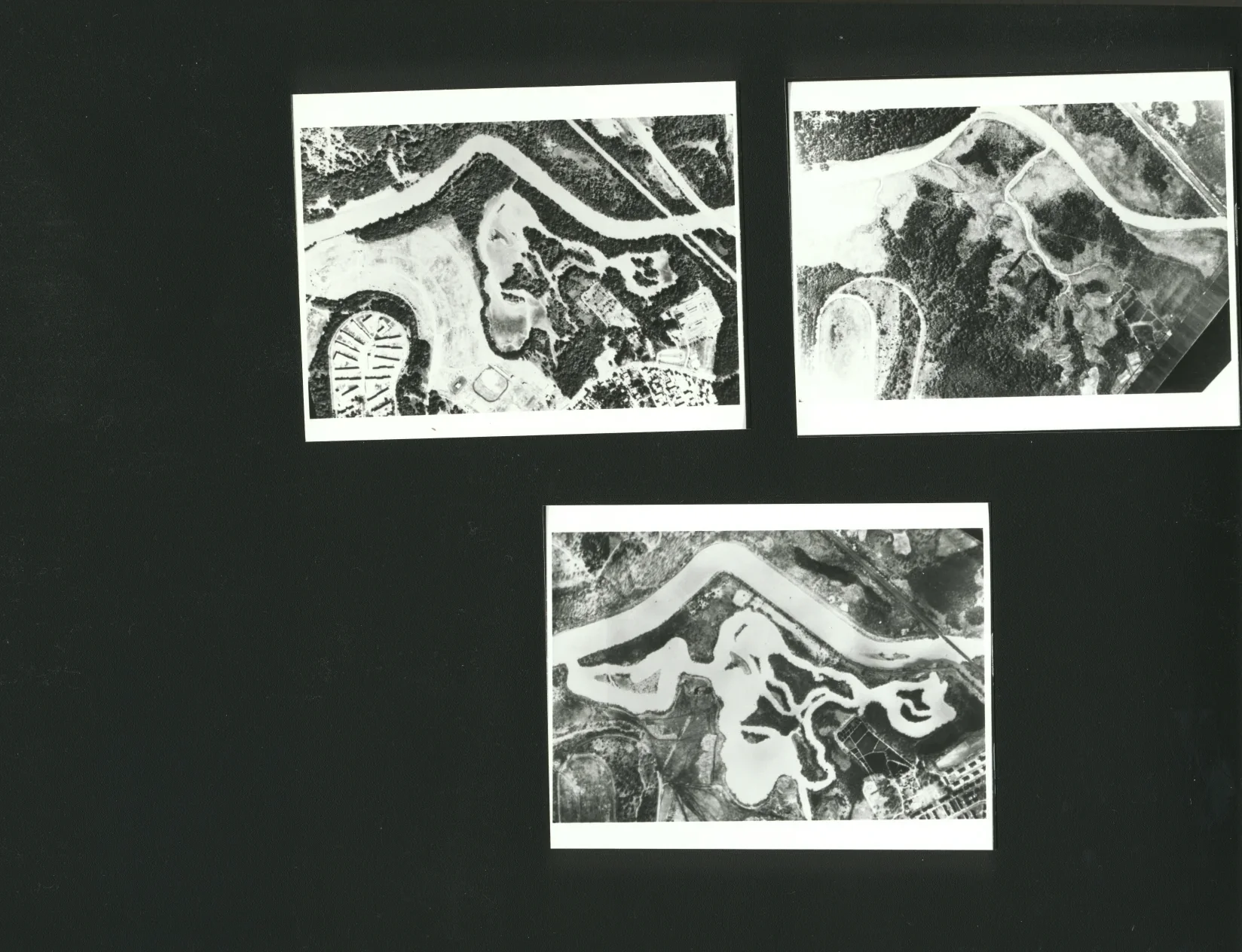
Kingman Lake and Kingman Island emerged from these interventions. Photographs from 1929 and 1930 show a landscape in transition: part river, part marsh, part construction project. The 1948 comparison makes the scale of change visible—water and wetland rearranged by policy, machinery, and disposal.
Engineering created parks and navigation improvements, but it also reduced and fragmented habitat. The river’s modern shape is not purely natural; it is a record of decisions.
THE INDUSTRIAL RIVER
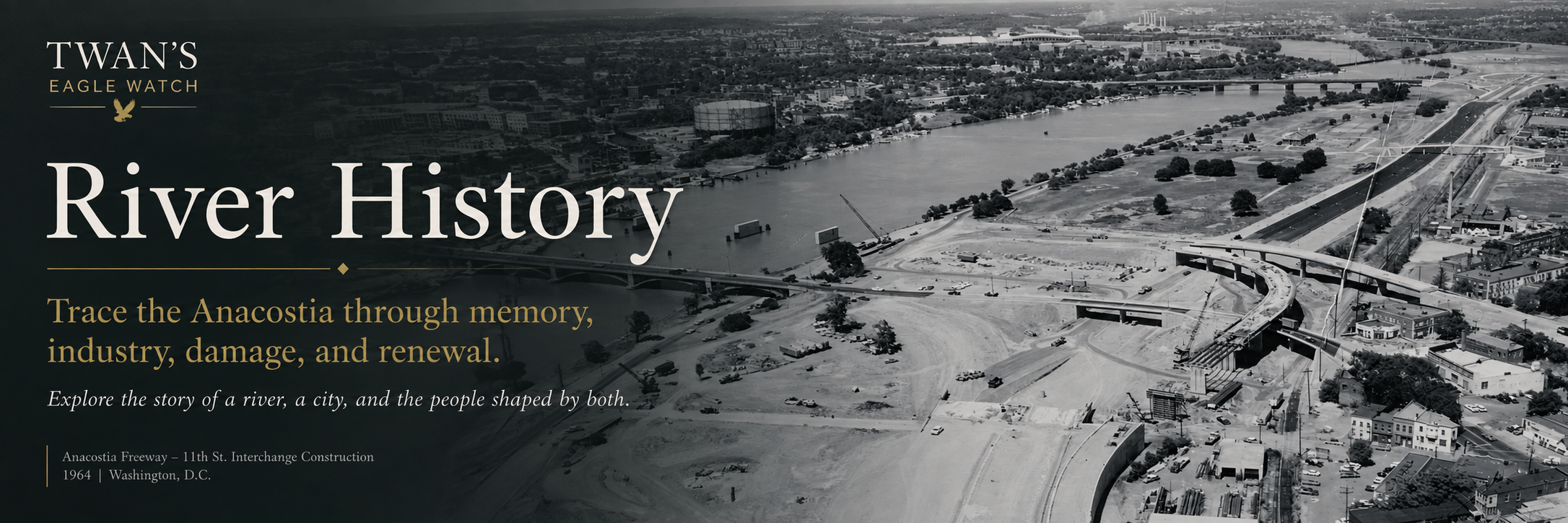
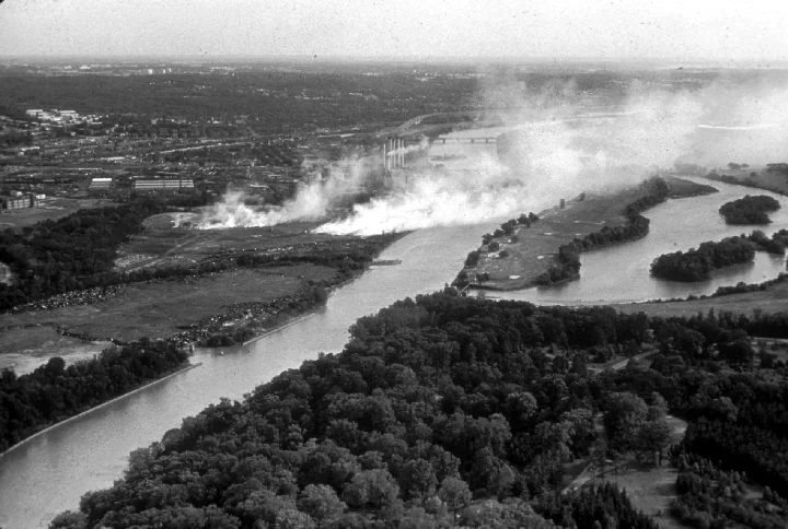
Factories, fuel tanks, rail lines, power facilities, military uses, highways, sewers, and heavy development crowded the river corridor. Aerial views from the mid-twentieth century show how completely industry and infrastructure came to frame the water.
The Anacostia helped power and supply Washington, but the benefits and burdens were not shared equally. Communities along the river—especially Black neighborhoods east of the Anacostia—lived closest to polluted tributaries, degraded shorelines, illegal dumping, and limited access to clean waterfront space.
Industrial growth changed not only the river’s chemistry and habitat. It changed who could reach the water, who bore the risk, and whose river knowledge was heard.
THE HARDEST CHAPTER
By the late twentieth century, decades of sewage, stormwater, contaminated sediment, industrial waste, trash, habitat loss, and shoreline neglect had made the Anacostia one of America’s most challenged urban rivers. Rain swept oil, metals, bacteria, plastic, and street debris through tributaries and outfalls.
Pollution was visible in floating trash and foul water, but other damage was buried in riverbed sediment or carried through food webs. Fish-consumption concerns, unsafe swimming conditions, eroded habitat, and disconnection from the shoreline shaped public memory of the river.
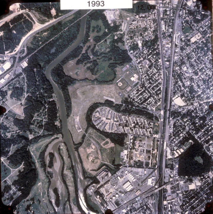
The 1967 industrial view, the 1980 river photograph, and later aerial comparisons make the damage legible. They also preserve the baseline from which recovery can be measured.
THE RIVER WAS STILL ALIVE
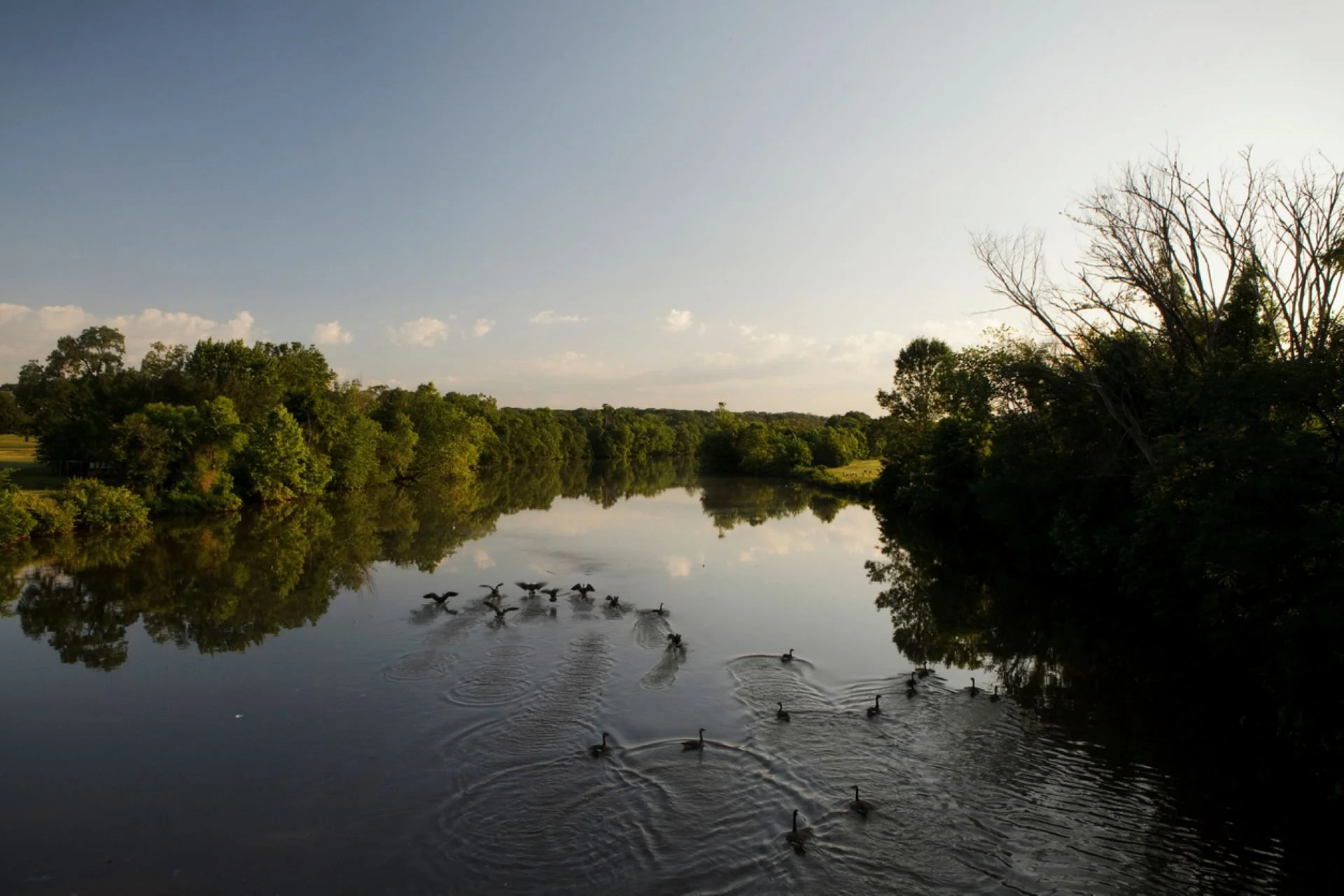
Even in its hardest period, the river was not dead. Tides still moved. Fish still migrated. Herons, ospreys, ducks, turtles, and other wildlife persisted where habitat remained. Seeds waited in wetland soil. Communities kept fishing, walking, watching, organizing, and demanding better.
That survival matters. Restoration did not begin with an empty channel; it began with a damaged living system and people who refused to abandon it. Cleanup crews, watershed groups, scientists, agencies, neighborhood leaders, students, and young environmental workers turned concern into sustained action.
The river’s recovery is not a miracle detached from labor. It is the result of thousands of decisions to return, document, remove, plant, monitor, teach, and protect.
RESTORATION BECOMES ACTION
Restoration took many forms: trash removal, wetland planting, stream repair, shoreline stabilization, habitat construction, environmental education, water-quality monitoring, policy change, and renewed public access. The Anacostia Watershed Society and many partners have restored wetlands and other habitat while communities continued pressing for a swimmable, fishable river.
Young people became central to that work. Earth Conservation Corps crews cleaned riverbanks, restored habitat, learned job skills, educated the public, and proved that environmental repair and human opportunity could advance together.
A restored wetland is more than planted vegetation. It is flood protection, wildlife habitat, cleaner water, a classroom, a workplace, and a statement that the river belongs in the future of Washington.
THE EAGLE RETURNS
The return of bald eagles to Washington became one of the most powerful signs that the Anacostia could support life again. Eagle restoration connected national symbolism with neighborhood stewardship: the bird on the seal of the United States depended on a real urban river, real fish, real trees, and real people protecting habitat.
For more than three decades, Twan Woods has watched this transformation from the shoreline and through a camera lens. His work connects eagle restoration, wildlife documentation, Earth Conservation Corps history, neighborhood memory, youth education, and the unfinished work of river recovery.
Watching is not passive. To witness over time is to build evidence—of nests, seasons, threats, return, and change.
Anacostia River · A living archive
River
History
A river older than the capital. A record of homeland, wildlife, labor, engineering, damage, resistance, restoration, and renewal.
RIVER HISTORY FILM · COMING SOON
Watch the history come alive.
Follow the Anacostia River through archival images, field footage, restoration work, wildlife return, and community witness.
The first chapter
The capital did not create the river. It inherited it.
Long before Washington, this tidal river moved through broad marshes, forested banks, tributaries, mudflats, coves, and productive shallows.
Indigenous communities lived within the greater Anacostia and Potomac region for thousands of years. At European contact, the Nacotchtank were the principal Indigenous people associated with the lower river.
The river was never background scenery. It was food, travel, shelter, trade, knowledge, identity, and life. River History begins there.
Explore the Nacotchtank PeopleThe nation’s river
Federal ambition meets an older waterway.
In 1790 and 1791, plans for a new federal capital were laid across an older river homeland. The L’Enfant plan organized avenues, squares, government buildings, and ceremonial space, but the Anacostia—then widely called the Eastern Branch—was already a geographic force.
The waterway shaped transportation, defense, settlement, commerce, and the growth of neighborhoods east and west of the channel.


A working river
Bridges, boats, labor, and consequence.
Nineteenth-century records show the Eastern Branch as a corridor of bridges, boats, wharves, timber, military movement, fishing, and commerce. The Navy Yard and riverside industries made the river essential to Washington’s economy.
Materials, vessels, and people moved along and across it. Navigation projects, shoreline construction, and urban waste also changed how the river flowed and what could survive in it.
Wild rice, marshes, abundance
Wetlands were infrastructure before the word existed.
Early records and photographs reveal extensive tidal marshes. Wild rice, aquatic plants, mudflats, islands, and shallow water supported fish, waterfowl, insects, turtles, and other wildlife.
Wetlands slowed water, stored sediment, softened floods, filtered pollutants, and created nursery habitat. Their abundance was ecological and social: families fished, hunted, gathered, traveled, worked, and spent time along the shoreline.
The 1902 marsh documentation and later wild-rice photographs are not empty landscapes. They are evidence of a functioning urban estuary before much of its shallow habitat was filled or re-engineered.
Explore Kenilworth historyEngineering the river
The modern shoreline is a record of decisions.
By the early twentieth century, officials increasingly treated tidal marshes as problems to control. Dredging deepened channels; excavated material filled wetlands and reshaped shorelines. Kingman Lake and Kingman Island emerged from these interventions.
Engineering created navigation channels and parkland, but it also reduced and fragmented habitat. National Park Service history records that the Anacostia River and Flats Act of 1914 led to seawalls, dredging, and filling that destroyed a natural wetland system.
Read the park-development recordThe industrial river
Washington grew. The river carried the burden.
Factories, fuel tanks, rail lines, power facilities, military uses, highways, sewers, and heavy development crowded the corridor. The river helped power and supply the city, but benefits and burdens were not shared equally.
Communities along the river—especially Black neighborhoods east of the Anacostia—lived closest to polluted tributaries, degraded shorelines, illegal dumping, and limited access to clean waterfront space.

The river was still alive
Damage was real. So was survival.
Even in its hardest period, tides moved. Fish migrated. Herons, ospreys, ducks, turtles, and other wildlife persisted where habitat remained. Seeds waited in wetland soil. Communities kept fishing, walking, watching, organizing, and demanding better.
Restoration did not begin with an empty channel. It began with a damaged living system and people who refused to abandon it.

Restoration becomes action
Hands in the work. Knowledge in motion.
Restoration includes trash removal, wetland planting, stream repair, shoreline stabilization, habitat construction, environmental education, water-quality monitoring, policy change, and renewed public access.
Young people became central to that work. Earth Conservation Corps crews cleaned riverbanks, restored habitat, learned job skills, educated the public, and showed that environmental repair and human opportunity could advance together.
A restored wetland is wildlife habitat, cleaner water, flood protection, a classroom, a workplace, and a statement that the river belongs in Washington’s future.
Explore habitat restorationExplore the Beaverdam Creek & Eagle Restoration Archive
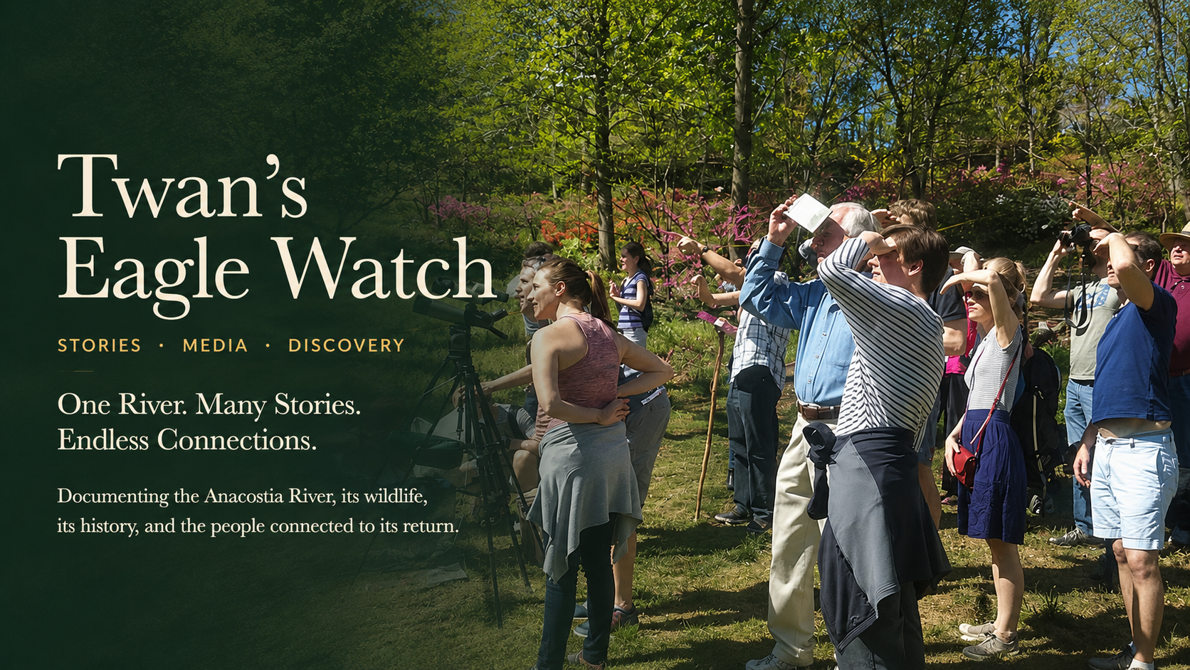
The eagle returns · the witness continues
Watching is not passive.
The return of bald eagles became a powerful sign that the Anacostia could support life again. The bird on the seal of the United States depends on a real urban river, real fish, real trees, and real people protecting habitat.
For more than three decades, Twan Woods has watched the river’s transformation from the shoreline and through a camera lens. To witness over time is to build evidence—of nests, seasons, threats, return, and change.
Enter Eagle WatchFollow the evidence
History becomes trustworthy when readers can enter the record.
Use these primary and authoritative starting points to verify the timeline, inspect catalog records, and explore the river’s continuing restoration.
Anacostia Park History & Timeline
Nacotchtank history, capital planning, dredging, filling, and park development.
Library of Congress1865 Navy Yard Bridge
Catalog record, date, description, reproduction number, and rights advisory.
SmithsonianThe Anacostia Story, 1608–1930
Anacostia Community Museum history and archival context.
District of ColumbiaAnacostia Waterfront Initiative
Public framework for restoration, access, parks, and waterfront development.
Anacostia Watershed SocietyHabitat Restoration
Wetlands, forests, native planting, volunteers, and current restoration work.
Government restoration planAnacostia Watershed Restoration Plan
Regional restoration history, goals, monitoring, and intergovernmental action.
The river connects us all
The river remembers.
What will we leave?
The next chapter is being written through restoration, wildlife recovery, community memory, youth leadership, and the choices made now.
River History
THE RIVER CONNECTS US ALL
Today the Anacostia is changing again. Trails, parks, wetlands, wildlife, and community spaces are bringing people back to the water. Yet recovery remains uneven, and restoration is not complete. Clean water, healthy sediment, safe access, habitat continuity, public memory, and environmental justice must move together.
The river connects Nacotchtank history, African American communities, industry, labor, youth leadership, bald eagle restoration, neighborhood life, and the future of Washington. No chapter stands alone.
When we protect the river, we protect the wildlife, the history, the communities, and the future—and we accept responsibility for what the next aerial photograph will show.